
From plastic to brittle deformation
The transition from plastic to brittle deformation occurred as the presently exposed rocks ascended through roughly 300 °C. In much of the Caledonian hinterland, this seems to have happened in the middle Devonian, and this transition marks the beginning of a prolonged period of repeated brittle deformation and exhumation that extended until today. 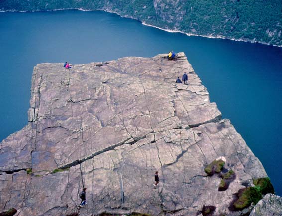
Fault kinematics, dikes and relative age
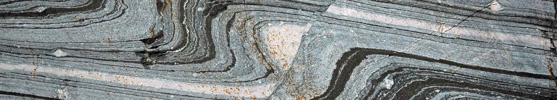
 Faults and fractures in the Caledonides show a large range of orientations, but in SW Norway they seem to define an early population consistent with NW-SE extension, and a later population that to a large extent conform with more or less E-W extension. Early faults and fractures are epidote-filled, while later ones are more commonly associated with calcite, among other minerals. This two-fold subdivision is of course a first-order approach only, and further work isindeed needed to fill inn or expand the picture. Alkaline dikes that occur along the coast are useful, as they seem to be associated with E-W extension and define two age groups at ~250 and 220 Ma. They seem to postdate the faults associated with NW-SE extension and are thought to be related to the first phase(s) of rifting of the North Sea rift system.
Dating of fault rocks
C lay minerals in fault rocks can be dated using the K-Ar method. The age gives us the time of clay mineral growth, which is thought to be related to flow of fluids along faults and probably episodes of fault movement and seismic activity. As part of her PhD work in Bergen, Anna Ksienzyk analyzed several samples of fault gouge from faults in SW Norway and found that the K-Ar ages cluster around 350-250 Ma, ~200 Ma, and ~150-130 Ma i addition to some younger ones. One of the goals is to establish a link between onshore observations and data and offshore North Sea information from seismic and well data. We believe that both the Permo-Triassic rift phase and the late Jurassic rift phase produced or reactivated faults onshore Norway, particularly in the areas near the coast.
Low-T thermochronology
A growing number ofapatite fission track and (U-Th)/He analyses from SW Norway have been obtained over the past few years by students at the U of Bergen at the lab set up by Prof. Joachim Jacobs. Apatite fission track and (U-Th)/He data suggest relatively constant cooling during Permian to early Jurassic times at rates of ~2 °C/Ma, and slower post-middle Jurassuc cooling (< 1°C/Ma). The data are equally compatible with surface exposure during the mid-late Jurassic but require mild reheating to 40-65 °C during the Cretaceous or Palaeogene. Both fission track and (U-Th)/He ages are offset across some coast-parallel faults, suggesting relatively late movements at least locally. Seismic activity is recorded along coast-parallel faults in this part of Norway, although foci are typically located at 10 km depth. This work is in progress, and data are accumulating.
The challenge is
the almost complete lack of post-middle Devonian sedimentary rocks onshore Scandinavia. A dash of Permian sandstone north of Oslo and a poorly exposed occurrence of Jurassic-Cretaceous sedimentary rocks on Andøya, North Norway is about all there is available. A summary is given here:
A controversy
Controversies, when presented and handled properly, can be both entertaining and useful, leading to renewed efforts and scientific advance. The classical interpretation of the low-relief Scandinavian mountain chain and its many flat-capped mountains is based on the assumption that these mountains represents remnants of erosion surfaces (peneplains) that formed close to sea level in the Mesozoic or early Cenozoic and subsequently uplifted and attacked by rivers and glaciers that created the deep and steep fjords and valleys that are so characteristic, perticularly of W Norway. This implies that the deep Caledonian root had more or less vanished by the Mesozoic.
The alternative ICE (isostasy–climate–erosion) theory, put forward by mostly Danish geologists, suggests that the Caledonian crust has been gradually thinned and mountains gradually lowered since the Early Devonian. They call for glacial and freeze–thaw processes involving the ‘glacial buzzsaw’ hypothesis to explain the widespread planar features of the present Scandinavian mountains.
 Hallingskarvet (close to 2000 m.a.s.l.), Hardangervidda, is one of many examples of flat-topped mountains in Norway. It rests on a lower-altitude (ca. 1100 m) peneplain, showing that there is more than a single peneplain to take into consideration.